Local Hazard Maps
Preloaded hazard maps for Bogo City, Cebu. All maps are available offline for emergency reference.
These maps are based on PHIVOLCS data and show areas at risk during earthquakes. Use them to plan evacuation routes and understand local hazards.
Available Maps
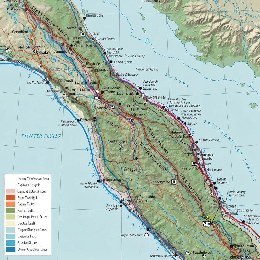
Active Fault Lines
Known active fault lines in Bogo City and surrounding areas
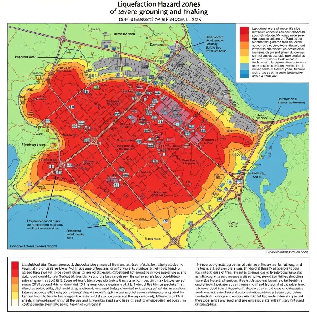
Liquefaction Susceptibility
Areas prone to soil liquefaction during earthquakes
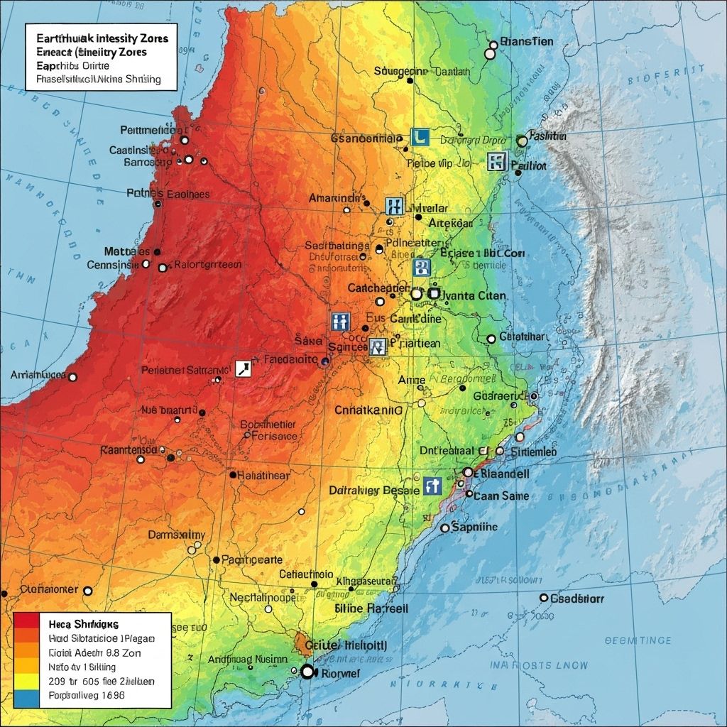
Ground Shaking Intensity
Expected ground shaking intensity zones
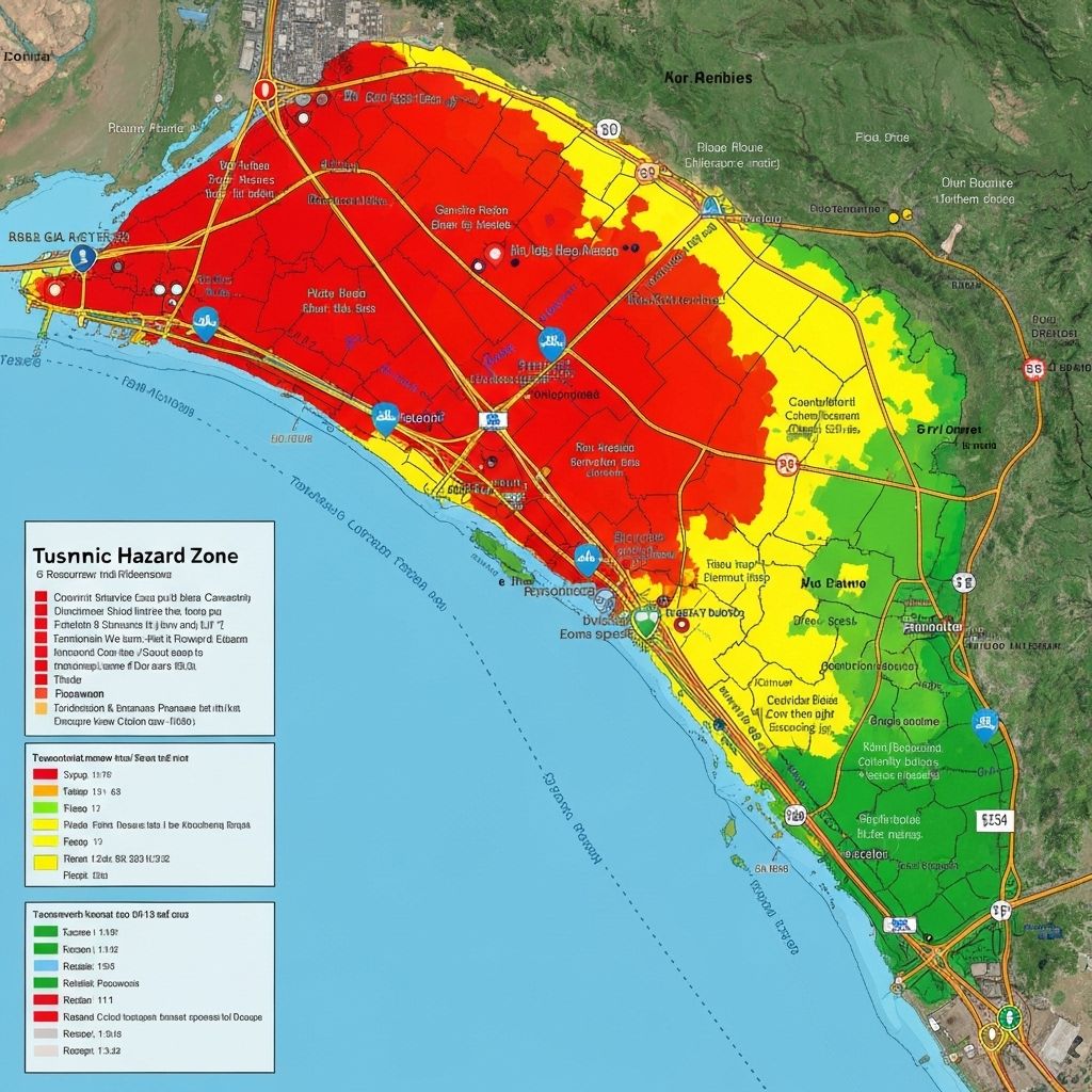
Tsunami Inundation
Potential tsunami inundation zones for coastal areas
Understanding Hazard Maps
Color Coding:
- Red zones: Highest risk areas, avoid if possible
- Orange zones: High risk, take extra precautions
- Yellow zones: Moderate risk, stay alert
- Green zones: Lower risk, but still prepare
How to Use:
- Identify your home and workplace on the maps
- Plan evacuation routes avoiding high-risk zones
- Share maps with family and neighbors
- Review maps regularly to stay prepared
Maps provided by PHIVOLCS (Philippine Institute of Volcanology and Seismology)
Last updated: October 2025